Halloween: The Game Maps Guide
An official-name map hub for East Haddonfield, Haddonfield Heights, Orange Grove Estates, and Town Center, with named landmarks and route boundaries.
FAQ
How many official maps are named?
Are fan street names included?
Do campaign and multiplayer use the same neighborhoods?
How many maps are official?
The official location material names four neighborhoods: East Haddonfield, Haddonfield Heights, Orange Grove Estates, and Town Center. This hub links each map’s confirmed landmarks and pairs them with civilian objectives and campaign chapters, while excluding street names that the source matrix does not verify. This page is organized around official landmarks, chapter context, and what the location sources leave unnamed. It gives the source-backed answer first, then separates adjacent claims so a player can check one result without treating an unlisted detail as confirmed.
This is a source-led answer, not a prediction. It gives you a way to choosing the first neighborhood and tells you where the wording came from: locations, orange, town, official, steam.
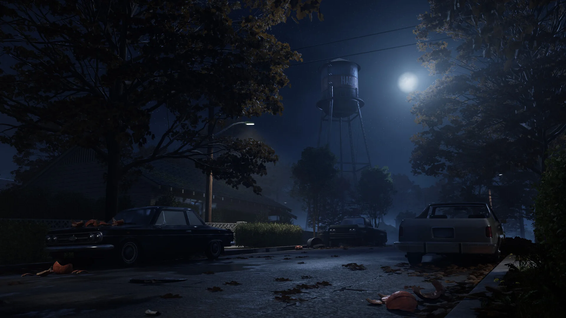
| Checkpoint | Published fact | Source role |
|---|---|---|
| Map count | Four launch neighborhoods are named in the official location material. | official locations article |
| East Haddonfield | Rabbit in Red Lounge, Phelps Garage, Castle Hill Rooks, and Midwest Feed Company are named. | official locations article |
| Heights | Strode house, abandoned Myers house, Lampkin Lane, and water tower are named. | official locations article |
| Town Center | Nichols Hardware, A-Side Music Store, Hill Garden Center, Patty’s Pub, post office, Margie’s Auto Repair, and cemetery are named. | official Town Center article |
What landmarks define East Haddonfield?
A player can act on east haddonfield without pretending the whole system is mapped. The checked wording is: Rabbit in Red Lounge, Phelps Garage, Castle Hill Rooks, and Midwest Feed Company are named. The next useful comparison is heights, which has its own evidence trail.
A useful check is to note the east haddonfield alongside the map, chapter, role, store, or build where you saw it. Then opening Rabbit in Red. If the prompt or result differs, preserve the observation and the date instead of silently upgrading it to a universal rule. Keep the question tied to the evidence. To opening Rabbit in Red, compare the in-game result with the published record from locations, orange, town, official, steam.
Which Heights locations are confirmed?
Treat Heights as the page’s working checkpoint. Strode house, abandoned Myers house, Lampkin Lane, and water tower are named. That is enough to checking the Heights houses; it is not evidence for an unlisted cooldown, spawn rule, reward, or score calculation.
A useful check is to note the heights alongside the map, chapter, role, store, or build where you saw it. Then checking the Heights houses. If the prompt or result differs, preserve the observation and the date instead of silently upgrading it to a universal rule. The checked sources (locations, orange, town, official, steam) support the named checkpoint; they do not turn an unlisted mechanic into a confirmed rule.
What is in Orange Grove?
The answer changes depending on what you are checking. For town center, the cited record says Nichols Hardware, A-Side Music Store, Hill Garden Center, Patty’s Pub, post office, Margie’s Auto Repair, and cemetery are named. Keep that beside the context for map count before reporting a result.
A useful check is to note the town center alongside the map, chapter, role, store, or build where you saw it. Then following Doyle and Wallace. If the prompt or result differs, preserve the observation and the date instead of silently upgrading it to a universal rule. Read this as an updateable field guide: following Doyle and Wallace is actionable now, while anything outside the cited wording stays open.
A reproducible first check looks like this:
- Open East Haddonfield and choose the named context before starting.
- Test Town Center before drawing conclusions about the wider system.
- Save the result with the build and the nearby Map count context.
- Compare the result with Haddonfield Heights before calling it a general rule.
Which Town Center POIs matter?
Start with Map count. Four launch neighborhoods are named in the official location material. The related source is official locations article. That distinction matters because east haddonfield is a neighboring checkpoint, not an automatic consequence of the first one.
A useful check is to note the map count alongside the map, chapter, role, store, or build where you saw it. Then using the Town Center businesses. If the prompt or result differs, preserve the observation and the date instead of silently upgrading it to a universal rule. For using the Town Center businesses, use the named fact as the checkpoint and the source list (locations, orange, town, official, steam) as the audit trail.
How should routes be learned?
The record separates East Haddonfield from Heights. It says Rabbit in Red Lounge, Phelps Garage, Castle Hill Rooks, and Midwest Feed Company are named. It also names strode house, abandoned myers house, lampkin lane, and water tower are named. Read those as two claims with two tests, rather than as a hidden formula.
A useful check is to note the east haddonfield alongside the map, chapter, role, store, or build where you saw it. Then keeping a route name official. If the prompt or result differs, preserve the observation and the date instead of silently upgrading it to a universal rule. The useful boundary here is practical: keeping a route name official can be checked against locations, orange, town, official, steam, but no unsupported rate or timer is added.
Where does the evidence stop?
The evidence set for this page is locations, orange, town, official, steam. It supports the rows above, but it does not publish every cooldown, spawn point, drop rate, score formula, cosmetic inventory, or farming route. Those omissions are deliberate. If a later official post or a reproducible in-game test adds one, update the row and its check date rather than backfilling the gap with a guess.
For the next step, open East Haddonfield and Haddonfield Heights. Those links carry the reader to a neighboring question instead of ending the session at a definition.
A practical next stop
Use civilian survival when you need the wider maps context, then return to East Haddonfield for the named checkpoint. Haddonfield Heights provides the second angle: it helps you separate map count from east haddonfield instead of combining them into one unsupported conclusion. The FAQ is a compact maintenance list; when a source changes, update the relevant row, wording, and last-modified date together.
Related videos


Related Articles
guides
Halloween: The Game Escape Routes Guide
A named-route guide to car, fence, storm drain, sewer, railroad, cornfield, bunker, and police-wagon escapes, with chapter and multiplayer boundaries.
maps
East Haddonfield Map Guide
A location-led East Haddonfield guide covering Rabbit in Red Lounge, Phelps Garage, Castle Hill Rooks, Midwest Feed, and rural route landmarks.
maps
Haddonfield Heights Map Guide
A sourced Haddonfield Heights map guide for Strode house, the abandoned Myers house, Lampkin Lane, water tower, and Returning Home context.
Was this helpful?
Thanks for the feedback!